

The Absolute High Point of Arkansas
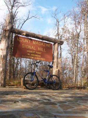
Earlier today, I biked/hiked to the high point in Arkansas, Signal Hill in Mt. Magazine State Park. In comparison to some of the other southern highpoints I've done on this trip, it's not that difficult to find or to get to, as long as you don't mind driving 40 or 50 miles along backroads.
A road appropriately named Circle Road runs around the high point, and a short trail bisects the circle road, heading to and from the highpoint. To make things slightly more interesting, I pushed the bike up and down the trail, and then when I got back to the road, I biked a semi-circle back to the starting point. It was pretty short and easy. It would have been nice to bike up and down the trail, but that's not allowed, and ethics is what we do when people aren't watching. As they say.
There were more difficult options, but due to timing and the possibility of thunderstorms later in the day, I decided not to do them. I could have gained 2000' to get to the highpoint, but I would have had to have hiked 18 miles round trip in order to get the same gain I could get in much less distance elsewhere. That's on the Cove Lake trail; there are various access points on that trail, but except for the longest version, the parking areas are in remote locations, and I didn't feel that parking there would be a wise decision.
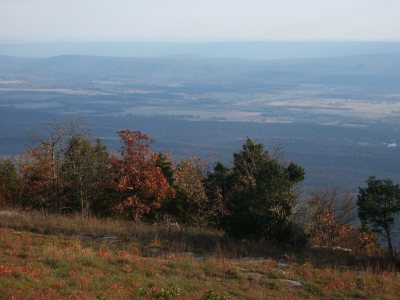
As on the highpoint of Virginia, there's no view from the highpoint. The second shot was taken near the site of the old lodge. That's also near the area where some rock climbing and hang-gliding takes place, but there was no one there partaking of those activities. I only saw one other person on the highpoint trail itself.